Eyeing a ridge lot in Black Mountain with sweeping Blue Ridge views? Choosing the right parcel is the difference between a home that lives effortlessly and a project weighed down by surprises. In this guide, you’ll learn how to evaluate view quality, slope and soil constraints, septic feasibility, access, hazards and permitting in Black Mountain and unincorporated Buncombe County. You’ll also get a practical checklist and the core team you need to move forward with confidence. Let’s dive in.
Start with jurisdiction and maps
Before you fall in love with the view, confirm who regulates the property. Lots inside the Town of Black Mountain are reviewed by the Town’s Building & Planning and Permits & Inspections team. Parcels in the county are handled by Buncombe County Planning & Development. Use the Town’s Permits & Inspections page to verify town review, and cross-check the parcel in Buncombe County’s GIS for zoning, contours, steep-slope overlays and flood layers.
Two mapping tools do most of the heavy lifting. The County GIS shows slope stability overlays, protected ridge areas and parcels. The FEMA Flood Map Service Center shows official flood insurance zones. Run both to understand constraints before you plan a homesite.
View quality: orientation and seasons
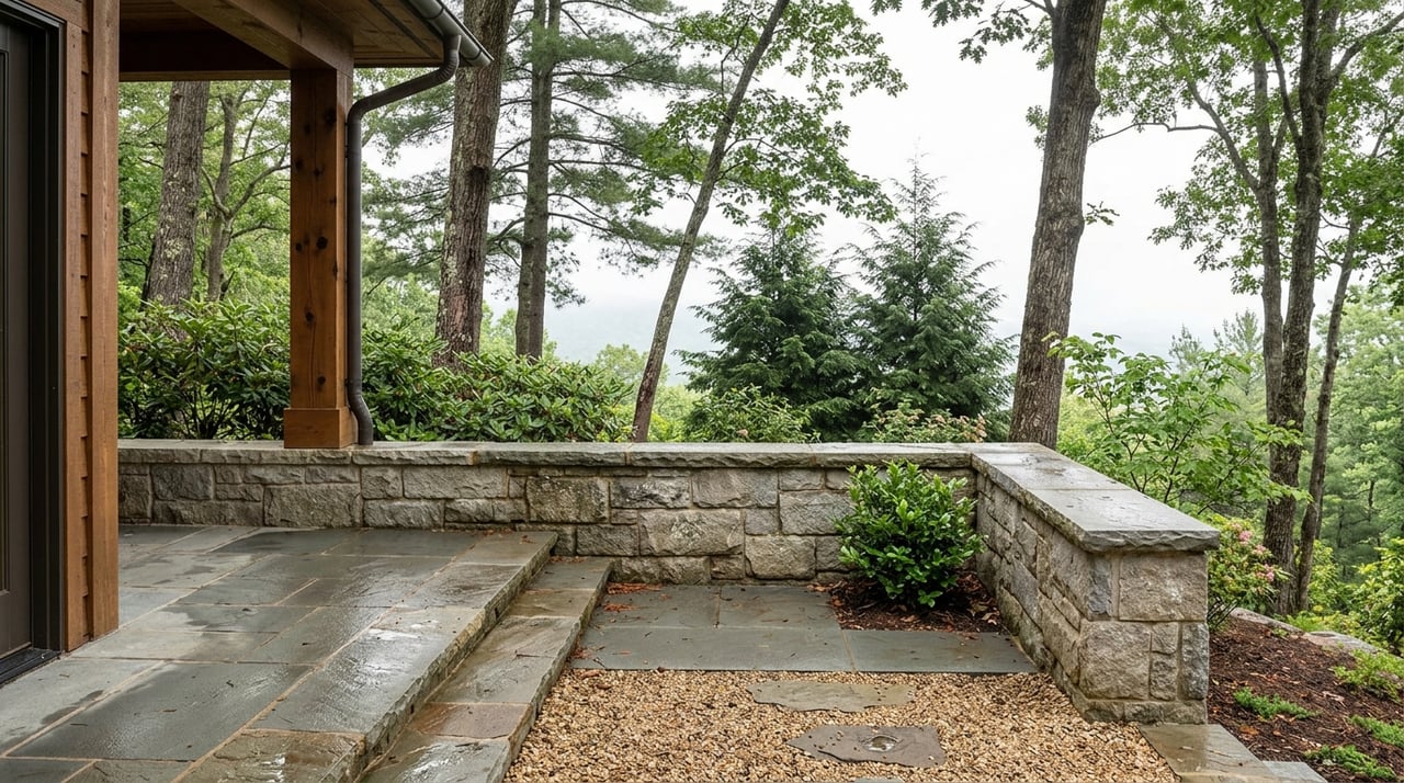
Great views rely on more than elevation. Orientation controls what you see, solar gain, and how trees affect the view across the year. Deciduous trees tend to open views in winter and soften or block views in summer. That seasonal shift also affects passive solar comfort inside your home.
- Visit during leaf-on and leaf-off seasons or ask for dated photos from both periods.
- Note sunrise and sunset angles from proposed living areas.
- Ask about recent pruning or removals and any planned plantings on adjacent parcels.
For a deeper design lens on managing sun and shade, see the Building America guidance on shading and solar control.
Slope, stability and buildability
Buncombe County’s land development rules set clear expectations for steep slopes, protected ridges and hillside work. If your proposed building area meets steep-slope triggers or is within the County Slope Stability Index Map’s moderate or high hazard zones, a registered North Carolina geotechnical engineer must provide a stability analysis before you build. In practice, a 35% slope is a commonly used technical trigger for global stability analysis in Buncombe County. Review the County’s Land Development & Subdivision Ordinance to understand where your site falls.
Steeper, exposed sites usually require engineered foundations, retaining walls and careful grading. These items increase cost and can reduce your buildable footprint. The County’s Hillside Development Application & Checklist outlines the submittals and studies typically required.
Topography and real costs
On long-range view ridgelines, expect stepped foundations, pier-and-beam or drilled-shaft solutions, and multiple retaining walls or terraces. Access drives may require cut-and-fill, guardrails, and drainage structures. Each element has design, permitting and maintenance implications that should be priced early in your feasibility phase.
Drainage, erosion and stormwater
Mountain water management is non-negotiable. If your site work disturbs the ground above local thresholds, the County will require erosion controls, stormwater plans and inspections. These rules protect your property and your neighbors downstream. Start with Buncombe’s Stormwater Management page to see permit triggers and responsibilities.
Septic, soils and utilities
If the lot is not on municipal sewer, septic suitability can make or break the purchase. Buncombe County Environmental Health handles evaluations, Improvement Permits and the Authorization to Construct. A building permit will not be issued until septic authorization is granted. Review the county process and forms on the Environmental Health page for onsite wastewater and wells.
- Order an on-site soils evaluation early. The NRCS soils map offers background context, but only a field evaluation and percolation testing confirm feasibility. You can preview county soils in the Buncombe Soil Survey, then rely on site testing for decisions.
- If soils are marginal, engineered or alternative septic systems may be required. Build time and budget for this possibility.
- Confirm whether municipal water or sewer is available, and request service maps and extension estimates from providers. The Town and County post utility notices and updates on regional recovery sites such as Black Mountain Recovery.
Access and driveway feasibility
Great views often sit atop challenging driveways. If your driveway connects to a state-maintained road, an NCDOT access permit is required. The policy addresses slope, sight distance, drainage and paved turnouts, which can influence design and cost. Review the NCDOT Policy on Street and Driveway Access and involve a civil engineer early to shape alignment and drainage.
Privacy, trees and easements
Trees make the mountain experience and, at times, hide the view. Smart view management focuses on selective pruning, canopy lifting or forming a defined view corridor while protecting roots. Poor practices can destabilize slopes or violate local rules. Engage an ISA-certified arborist and follow best practices for tree protection during construction.
Recorded rights also matter. Pull the deed, plat and any covenants at the Buncombe County Register of Deeds to spot view easements, conservation easements, utility corridors or height and clearing restrictions. These obligations travel with the land and can limit where and how you build or manage vegetation.
Hazards: flood and landslide awareness
If the parcel is near a stream or valley edge, confirm whether any portion falls within a FEMA flood zone using the FEMA Flood Map Service Center. Separately, the September 2024 Hurricane Helene event triggered widespread landslides across Western North Carolina. Review the USGS preliminary landslide inventory and discuss site history and any mapped hazards with County Planning. Understanding where your lot sits relative to documented slides is a key part of risk management in the 2024–2026 period.
Design moves that protect the view and budget
Designers have well-tested solutions for steep, view-driven homes. Expect your architect and engineers to ask for early surveys, soils data and utility locations to refine the footprint.
- Foundations and earthworks: Geotechnical recommendations drive choices like stepped footings, piers, caissons and retaining walls. County steep-slope rules and required geotechnical reviews help right-size these solutions. See the Subdivision Ordinance for context.
- Glazing, decks and solar control: Architects balance big view windows and outdoor rooms with shading to maintain comfort and durability. The Building America resource on shading and solar control is a useful reference during design.
- Tree protection: Define a narrow view corridor, then protect adjacent canopy and root zones with fencing and clear construction limits to preserve long-term stability and privacy.
- Long-term maintenance: Budget for periodic tree work, driveway resurfacing, culvert cleaning, and retaining-wall inspections to preserve both the view and the asset.
Your due-diligence checklist
Use this list before you commit or as contingencies in your offer.
- Confirm jurisdiction. Determine whether the parcel is inside the Town of Black Mountain or unincorporated Buncombe. Start with the Town’s Building & Planning.
- Pull recorded documents. Retrieve the deed, plat, CCRs and easements at the County Register of Deeds. Look for view or conservation easements and height or tree restrictions.
- Run County GIS layers. Use Buncombe County GIS to check contours, steep-slope and ridge overlays, slope stability and flood layers.
- Order an ALTA/topographic survey. Map trees, contours, proposed building envelopes, and septic/well areas. Ask the surveyor to flag potential homesites on the ground.
- Collect existing records. Request seller disclosures, prior septic permits (Improvement Permit, ATC, as-builts), wells and any geotechnical studies. Cross-check with Environmental Health.
- Scope geotechnical needs. If slopes are near county triggers or mapped as moderate/high hazard, engage a registered geotechnical engineer. A global stability analysis may be required under the Subdivision Ordinance.
- Test driveway feasibility. If access ties to a state road, confirm NCDOT permit needs and sight-distance constraints. Review the driveway access policy and get a concept from a civil engineer.
- Check flood and landslide mapping. Verify FEMA zones via the FEMA Map Service Center. Ask County Planning about Helene-related mapping and hillside history, and review the USGS Helene landslide inventory.
- Confirm utilities. Request service maps and extension estimates for electric, water and sewer. For updates and local guidance, see Black Mountain Recovery.
- Engage an ISA-certified arborist. Seek guidance on view-friendly pruning and root protection, and request a tree-protection plan aligned with construction.
- Review HOA/CCR design rules. Confirm any architectural review, height limits, or landscape standards that affect view management.
- Build a contingency budget. Include line items for geotechnical work, foundation premiums, retaining walls, driveway engineering, engineered septic if needed, and tree management. These items commonly add significant cost on steep view lots.
Who belongs on your team
- Land surveyor for ALTA/topo and staking.
- Civil/site engineer for driveway, drainage and stormwater compliance.
- Geotechnical engineer for stability analysis and foundation recommendations.
- Septic designer or Authorized On-Site Wastewater Evaluator for on-lot systems, coordinated with Environmental Health.
- ISA-certified arborist for tree protection and view corridor planning.
- Architect experienced with sloped sites and long-range mountain views.
- General contractor with steep-site construction expertise.
- Real estate attorney or title company to review easements, CCRs and title exceptions.
Next steps
The best view lots in Black Mountain pair a remarkable outlook with the right underlying conditions. When you verify jurisdiction, map constraints early, confirm septic and access, and plan for hillside design, you protect your vision and your budget. With the right team, you can preserve the view you fell in love with and deliver a luxury home that performs for decades.
If you are weighing two or three candidate parcels or want a confidential second opinion on feasibility and value, connect with Marilyn Wright for a private consultation. Her combination of local construction literacy and discreet, high-touch advisory can help you move decisively and confidently.
FAQs
What should I check first when evaluating a Black Mountain view lot?
- Start by confirming jurisdiction, then run the parcel in Buncombe County GIS for steep-slope, ridge and flood overlays, and verify flood zones in the FEMA Map Service Center.
How do Buncombe County steep-slope rules affect my luxury build?
- If your homesite meets steep-slope or protected ridge triggers, you will need geotechnical analysis and must follow limits on cuts, fills and building height set by the Subdivision Ordinance.
How can I tell if a lot will pass septic in Buncombe County?
- Only an on-site evaluation by Environmental Health can confirm feasibility; if suitable, they issue an Improvement Permit and Authorization to Construct, which you need before a building permit. See the county’s onsite wastewater page.
Do I need an NCDOT permit for my driveway in the mountains?
- If your driveway connects to a state road, NCDOT requires an access permit with standards for slope, sight distance and drainage; review the driveway access policy.
How did Hurricane Helene change landslide risk considerations?
- The September 2024 event triggered widespread slides across Western North Carolina; buyers should review the USGS preliminary landslide inventory and consult County Planning about site-specific hillside history.
What is the best way to manage trees without losing my view?
- Work with an ISA-certified arborist to define a narrow view corridor, use selective pruning and root-zone protection, and follow best practices for tree protection during construction.
